|
| Our campsite next to Murray River near the Overland Corner Hotel |
 |
| Looking down the river from our camp after sunset |
 |
| Great place for a meal at the Overland Corner Hotel built 1859 |
As we got closer to Adelaide and Easter arrived, we spent time at the riverside towns of both Cadell and Swan Reach enjoying the various forms of boat traffic cruising past us whilst trying to stay away from the hordes of people enjoying Easter fun around and on the river.
 |
Houseboats were parked along the banks for the river at Swan Reach
along with people camping in tents, with jet skis always on the go |
 |
The Murray has many bends in it and people have built stunning
holiday homes along its banks to enjoy fishing, skiing and jet skis |
In SA there are many free ferries taking cars and people across the river and during Easter, at Swan Reach we were in queues of people on foot waiting to cross! |
Free ferry taking vehicles and people constantly
across the river at Swan Reach |
 |
| Even a tourist paddleboat came gliding past us at Swan Reach |
Wheat Silos Anyone
My cousin and friends with the farm told us a lot about art to be found painted on very large wheat silos in parts of Victoria (Vic) so we changed our route to have a look through an area in western Vic called the Mallee & Wimmera.
We started in earnest after spending a night next to Lake Boga, home to WWII Catalina flying boats from June 1942 after 16 of them were destroyed during the Japanese bombing of Darwin and Broome earlier. The history learned in this purpose built museum was well worth the visit.
 |
Catalinas were used to attack Japanese submarines during
WWII and patrol all the way to Papua New Guinea |
Over the next 4 days we followed much of the ‘silo trail’ to see the work of some obviously very skilled artists who created some emotive works on the sides of those very large structures. |
| Main towns along the 'silo art trail' in western Victoria |
 |
Explanation of how the 'silo art trail'
project eventuated and when |
 |
The actual route we travelled from Lake Boga along the 'silo art trail'
showing its location relative to both Melbourne & Adelaide |
The photos which follow show the different styles of art on wheat silos created by special artists in each of the towns they are situated. Which is your favourite?
 |
| Some very thought provoking artwork on each silo |
But it wasn’t all about silos because we were also driving through very small country towns where Rob had spent many years visiting relatives who lived in them. For her it was a bit of a trip down memory lane but came with a few surprises.
Rob’s father grew up in the town of Murtoa along with her grandparents and aunty, so she had visited it often and knew of a place called the Stick Shed built in 1944 to store wheat grain during and after WWII. She had never visited it and now was the time… oh boy!
 |
| Outside the vast Stick Shed in Murtoa |
What a structure it was, especially when we stepped inside and truly appreciated the scale and underlying construction of it.
 |
The small person is Rob standing inside the massive Stick Shed
used to store and protect thousands of tonnes of crucial wheat grain |
Another pleasant surprise happened whilst visiting Hopetoun, another town familiar to Rob whose Aunty had lived there. It is a typical small country town but right next to it is a magnificent area of water called Lake Lascelles around which you can simply select a location to free camp which we did for a few days.
 |
| Our camping spot next to Lake Lascelles for a few days |
 |
| View after sunrise from camping spot, Lake Lascelles |
Two Peninsulas
After spending a brief time in Adelaide visiting my mother in aged care, we continued our journey westward but not before going via Port Augusta on our way to one of two peninsulas, the first being Yorke.
 |
The route we took down both the Yorke
and Eyre Peninsulas, South Australia |
As we neared Port Augusta, we could see a strange bright white light stationary above the ground. The closer we got, the larger and brighter this light got so with the help of Google we discovered it is the Aurora project, a tower full of molten salt standing about 250 metres high, eventually to be surrounded by more than 10,000 heliostats — movable mirrors, the size of billboards, programmed to track the sun year round. |
The glowing tower of the Aurora Project heating
molten salt to generate power at night |
During the day, mirrors will reflect and concentrate sunlight, beaming it onto a receiver straddling the top of the tower ensuring molten salt flows through the receiver and heated to temperatures as high as 566 degrees Celsius, then stored in tanks overnight for use to create electricity when needed at night.
Yorke Peninsula is essentially dedicated to farming, wheat or sheep and with such large paddocks, and is not blessed with a many trees. With SA also being the driest State in the driest continent on the planet, also explains why most houses are either made of bricks or local stone, again due to the lack of trees.
 |
Overnight camp location on coastline of Yorke Peninsula,
not a tall tree in sight |
We visited many small towns as we made our way to the ‘foot’ of Yorke Peninsula to camp in Innes National Park amongst sand dunes and with easy access to the sea and multiple interesting old fishing camps or small bays. |
| Beautiful bay, fishing boats at anchor in Innes Nat. Park |
 |
| Old buildings of gypsum miners from the 1880's |
 |
| Rugged coastline around Innes Nat. Park |
 |
| Perfect way to finish our stay in the park |
Eyre Peninsula really starts from around Port Lincoln, a city famous for its tuna farm industry and after a few days staying there we spent a few more days camped in the Port Lincoln National Park. |
| Pt Lincoln is famous for tuna fishing and the fortunes created |
After bouncing our way over ruts and rocks, we found a spot to stay in the National Park for a few nights near the edge of a small cliff overlooking a large bay and beach. It was very peaceful taking long walks around the bay looking at the coloured boulders or watching the birds perched on rocks near the cliff. We even had a dolphin come into the bay chasing fish.
 |
Where we set up provided great views across the water easy
access to the coastline and beach |
 |
Our view to the bay we enjoyed walking around | | Walking around the bay on a very shelly beach |
|
 |
The rocky coastline was beautiful during sunset as was the
bay a safe overnight anchor location for fishing boats |
Having decided to head further west towards the Western Australian border, we followed the very picturesque coastline of Eyre Peninsula starting with a visit to Coffin Bay, renowned for its oysters which came in various styles and were delicious.
 |
| Very big choice of oyster styles on menu to choose from |
 |
| Enjoying delicious oysters with wine for lunch |
 |
| Tourists returning to dry land after an oyster education tour |
Further along this rugged coast were a few free camping locations we enjoyed for a few nights each with panoramic views of the surging ocean doing its best to reshape the beach. The constant action of the ocean has also created some fascinating shapes in the rocks and even tunnels into the shoreline.
 |
| We set up overnight at Drummond Point |
 |
| The coastline at Drummond Point was very rugged and worn |
 |
| This location is called Woolshed Cave on the Eyre Peninsula coastline |
 |
| This is why it is called Woolshed Cave |
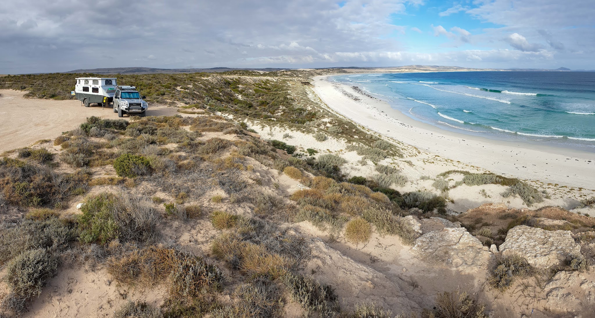
We found a surprising place to stay at Perlubie Beach where we camped along with a lot of others on the beach for a night.
 |
| Ours is the small van at left on Perlubie Beach |
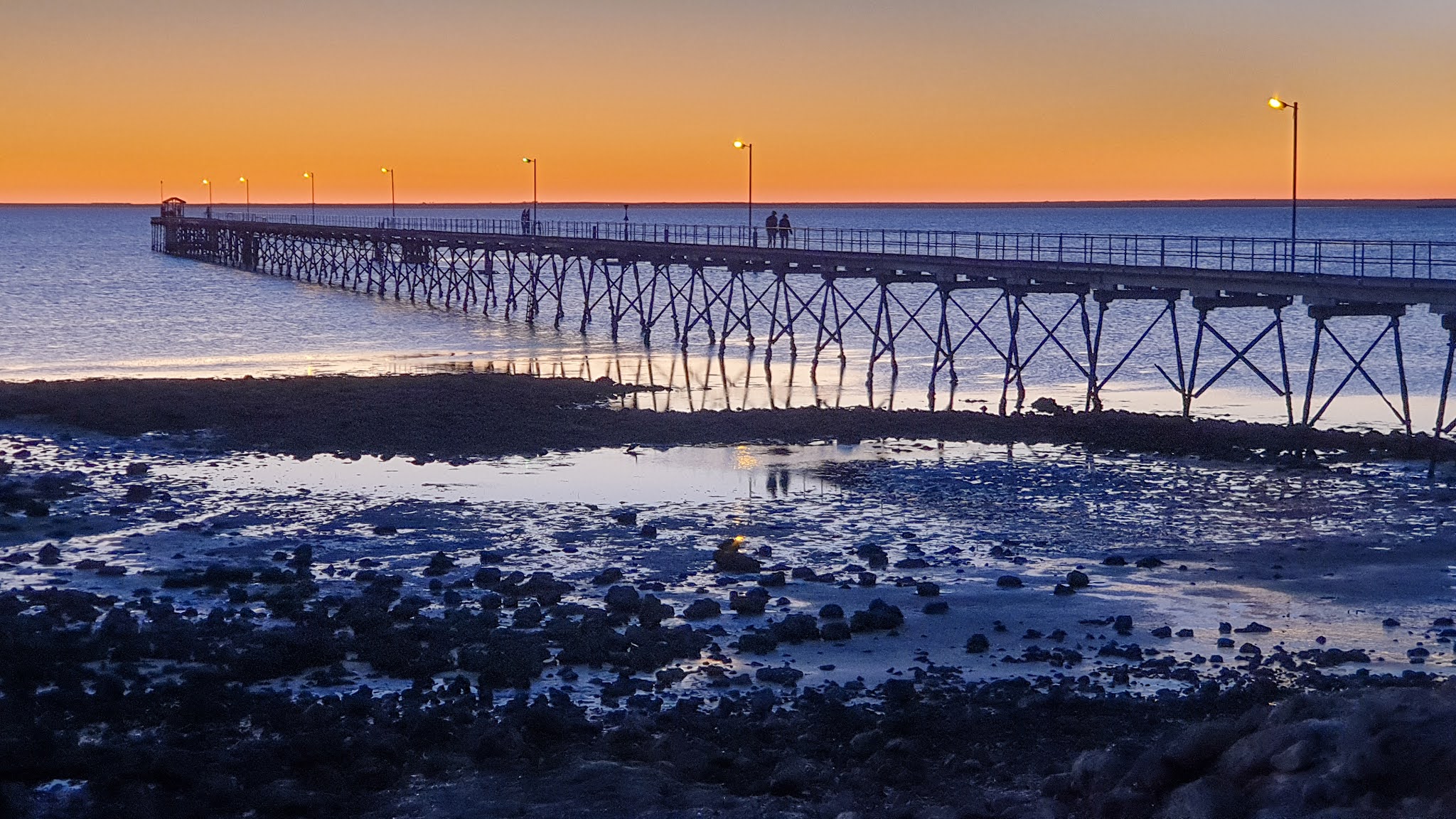
Ceduna is a very pleasant town, popular with Victorians who go fishing for whiting daily and stay for months at a time. The area along the shoreline is beautifully designed and presented.
 |
| Ceduna jetty and beach at sunset |
 |
| Ceduna is very proud of itself and it shows |
Little further along but inland from the coast, we reached the small town of Penong at the western tip of Eyre Peninsula, where a few surprises could be found.
The first is located on the way to Cactus Beach, a historical and popular remote surfing location for decades. To reach the beach, we needed to drive using a causeway to cross Lake MacDonnell also known as the pink & blue lake.
 |
| Both the beach and one of the surfing breaks at the very remote Cactus Beach |
 |
| Pink and blue lakes whilst crossing the causeway at Lake MacDonnell |
 |
| Yes looks weird but a 360 deg photo taken using the drone |
Back in Penong and with sunset looming, we wandered down to a local tourist attraction called the Windmill Museum but did not expect what happened as the sun was just above the horizon… spectacular! |
Sunset making the windmill blades glow at the
windmill museum in Penong |
Still heading west we had reached something called the Nullarbor Plains, the worlds largest exposure of limestone rock and around 1,100 kms in length. Nullarbor means treeless in latin and is meant to describe this area as being almost treeless for its entire length.
A short distance west of Penong and having re-fuelled at the closest roadhouse, we turned directly north off the main highway and travelled for 200+ kms into the very barren Great Victoria Desert, including crossing the Transcontinental railway running from Port Augusta towards Perth in WA.
 |
Transcontinental railway in the Great Victoria desert crossing the Nullarbor
and start of longest straight stretch of railway in the world at 478 kms long |
Why were we out in the middle of 'nothing'… we were on our way to the infamous location of Maralinga!
Atomic Bombs
We were also on the indigenous lands of the southern Pitjantjatjara people, so needed a permit to enter their land and were only allowed to drive directly to Maralinga and return to the Eyre Highway on the same road.
You can only visit Maralinga on a guided tour and after being let through the security gates by our hosts, we set up camp on a former building’s concrete slab, one of many bare slabs remaining after most of the original buildings had been dismantled and removed.
 |
| This shows our route to and where Maralinga is located |
 |
| Set up on what was a building location at Maralinga |
 |
5 other people had also driven into Maralinga and they
were great company for the 2 nights we were all there |
In 1956, Operation Buffalo commenced which involved testing British nuclear bombs on Australian soil. As interestingly, approval for do this apparently didn’t go via Australia’s Federal Parliament and much of the activity was shrouded in massive secrecy… and still is.
 |
| Young wild dingo came into check out everyones campsite |
 |
| Lots of wild camels can be found around Maralinga |
At one stage there were 5,000 people located in Maralinga, most of them British soldiers or scientists and they were in the main, not allowed to know what others were doing and were restricted from going into designated areas.
Much of the building material was flown in from the UK, especially after a massive runway was built, still in perfect condition 65 years later and once an emergency landing location for the USA space shuttle.
 |
| Standing on the very long runway during our tour |
Our tour started at 9am and finished around 5:30pm and was one of the best tours we have ever been on with constant surprises, learnings and experiences. Our hosts, a couple living onsite were genuinely very nice people.
 |
The tour route at Maralinga and the large white dots are
where major atomic explosions occurred |
There were multiple atomic bombs exploded either sitting on towers, held aloft by large balloons and one dropped from a plane. We stood at ground zero of a few of the blast sites including one where the bomb was 20x larger than the one dropped on Hiroshima! There were also hundreds to thousands of ‘minor’ explosions scattered all over the place testing for who never will know what.
 |
| One of the ground zero locations at Maralinga compliments of Google |
 |
The sign above describes the test which occurred at the ground
zero location we are standing at during the tour |
At another ground zero site, the blast created a hole 60 metres in diameter and 30 metres deep. All the local nomadic aboriginals were supposedly moved away but a few days later, the scientists found a family sitting at the bottom of the hole because it was still warm from the explosion.
The mother was pregnant and lost her child and other members of the family fell ill, some died and subsequent relatives have had ongoing health conditions.
 |
| Visiting another ground zero location during tour |
Allegedly many horrible things happened as a result of the troops wearing only their uniforms being asked to do ‘scientific’ tasks like crawling on their knees through the blast zone looking for remains whilst the scientists were wearing protective gear. |
| These vehicles were used to transport people safely around the site |
We had lunch under big sheds near where all the radioactive remains were finally and properly buried before 1995 when the land was handed back to the traditional owners, not that they want to live on the affected land to this day. All the equipment used to bury contaminated material had to also be buried and nothing could leave Maralinga.
 |
| Lunch under the sheds used during the last burial of radioactive material |
Is it still radioactive you might be asking? During the tour, our hosts constantly took geiger counter readings and they were within safe limits. We were allowed to pick up some slightly radioactive glass like objects formed by the blasts which were also measured, but we had to leave them where we found them and make sure we washed our hands afterwards.
 |
Testing radiation levels above light
green glass like objects on ground |
There were all sorts of weird and wonderful stories we heard about this strange historical location still sitting in the middle of nowhere and we’re pleased we made the effort to learn more about this part of our history.
The Nullarbor
By now we had made a decision to continue on into the State of WA despite there being a small covid outbreak in the capital of Perth, which had precipitated a lockdown in 2 defined areas.
The massive Nullarbor Plain has the Great Victoria Desert to its north and the Great Australian Bight coastline to its south and over a few nights we set up camp at different locations to enjoy the magnificent views along the coastline from the Bunda Cliff zone.
 |
| Desolate camp location at start of the Nullarbor before reaching coast |
With the help of the drone, we hopefully captured the real reasons for staying here and enjoying the environment. The cliffs abruptly drop 60-120 metres to the surging Southern Ocean and the contrast in colours between cliffs and sea adds to the spectacle.
 |
| Hopefully the photos speak for themselves at these amazing locations |
Driving the rest of the Nullarbor involved more free camping, driving the longest straight section of road in Australia and seeing some of the most iconic road signs in Australia.
 |
| This sign features in many tourist brochures |
 |
| There is always something to see when crossing the Nullarbor |
 |
| Another free camp after crossing the Nullarbor... trees were back |
A Beautiful Blue
After negotiating the WA border checks by Police and then the bio quarantine inspections to stop the wrong foods and pests also entering WA, we at long last reached the town of Esperance, located on a beautifully scenic coastline. We stayed a few nights in a temporary overflow camping area created due to the sheer number of other travellers visiting WA now that WA was finally open again.
 |
| Some gorgeous coastline to enjoy at Esperance |
Esperance was as far west as we were venturing into the State of WA before turning somehow towards the east, but not before managing to obtain a booking for 2 nights in a very full Cape Le Grand Nat. Park. We were here to re-experience the glaringly white squeaky sands of the beaches and vivid aqua water colour of Lucky Bay amongst others.
 |
| The sand at Lucky Bay is extremely fine and white |
 |
| What can we say... thank you drone |
Longest Shortcut
Rather than drive back across the Nullarbor, we ventured north from Esperance via Norseman, Kalgoorlie, then Laverton where we joined a road to reach a small town called Leonora and what is left of a tiny gold mining location nearby called Gwalia, where now only 20 houses remain.
 |
The massive open cut 'super pit' mine at Kalgoorlie where
we stayed for 2 nights |
Gwalia was a fascinating place to drive around and a nice unknown surprise. The old pub and some of the ramshackle homes the original gold miners lived in would have been able to share a lot of stories. |
| Old hotel in the ghost town of Gwalia |
 |
| The miners out here back in the late 1800s did it very tough indeed |
Herbert Hoover, an American engineer at the time, was appointed General Manager for the mine in 1898 and what is special about Hoover was that he went on to be President of the USA in 1929.
 |
| Open pit mining still underway at Gwalia |
Leonora is where the Great Central Road starts, all 1,126 kms of it, crossing the remote Gibson Desert and part of a combination of roads nicknamed The Longest Shortcut or Outback Way allowing people to drive from Laverton in WA to Winton, QLD.
 |
| It tooks us 4 days and 3 nights of remote camping to cross the Great Central Road |
Most of this road was dirt of varying degrees of quality from very corrugated to quite smooth and with constant changes of colour from a dull yellow to orange/red with some wonderful scenery to admire also constantly changing.
 |
| First camp spot as we started our crossing of the Great Central Road |
 |
| Sunrise at Giles Breakaway |
To travel this road we also had to have permits from the indigenous communities to travel through their land within a defined number of days. We also stopped for fuel in a few indigenous communities and learnt more about their lifestyle.
 |
| Wild camels are an interesting traffic hazard on this road |
 |
| There were literally hundreds of wrecked cars either side of the road |
At one indigenous roadhouse we could have bought frozen kangaroo tail proudly on display in the freezer units!
We also learned quite directly about the importance of ‘country’ to them. Some of the aboriginals living at Maralinga were moved ~900 kms to another communities ‘country’ area near the Warakurna roadhouse close to the NT border.
To this day, the local indigenous community have not accepted those moved there over 60+ yrs ago and there was some tension happening between them on the day we passed through.
 |
| This typifies what the Great Central Road is like... long stretches of dirt road, open spaces and colourful |
We free camped in some very remote locations the 4 days it took to traverse the Great Central Road and when leaving the last one to cross into Northern Territory (NT) we discovered 2 of our 4 shock absorbers under the van had failed, one even coming apart which required some bush style repairs to let us keep going.
 |
Perhaps our most remote camp location near the end
of the crossing and literally in the middle of nowhere |
 |
| With no moon and massive empty space around us had to have a go at a night milky way photo |
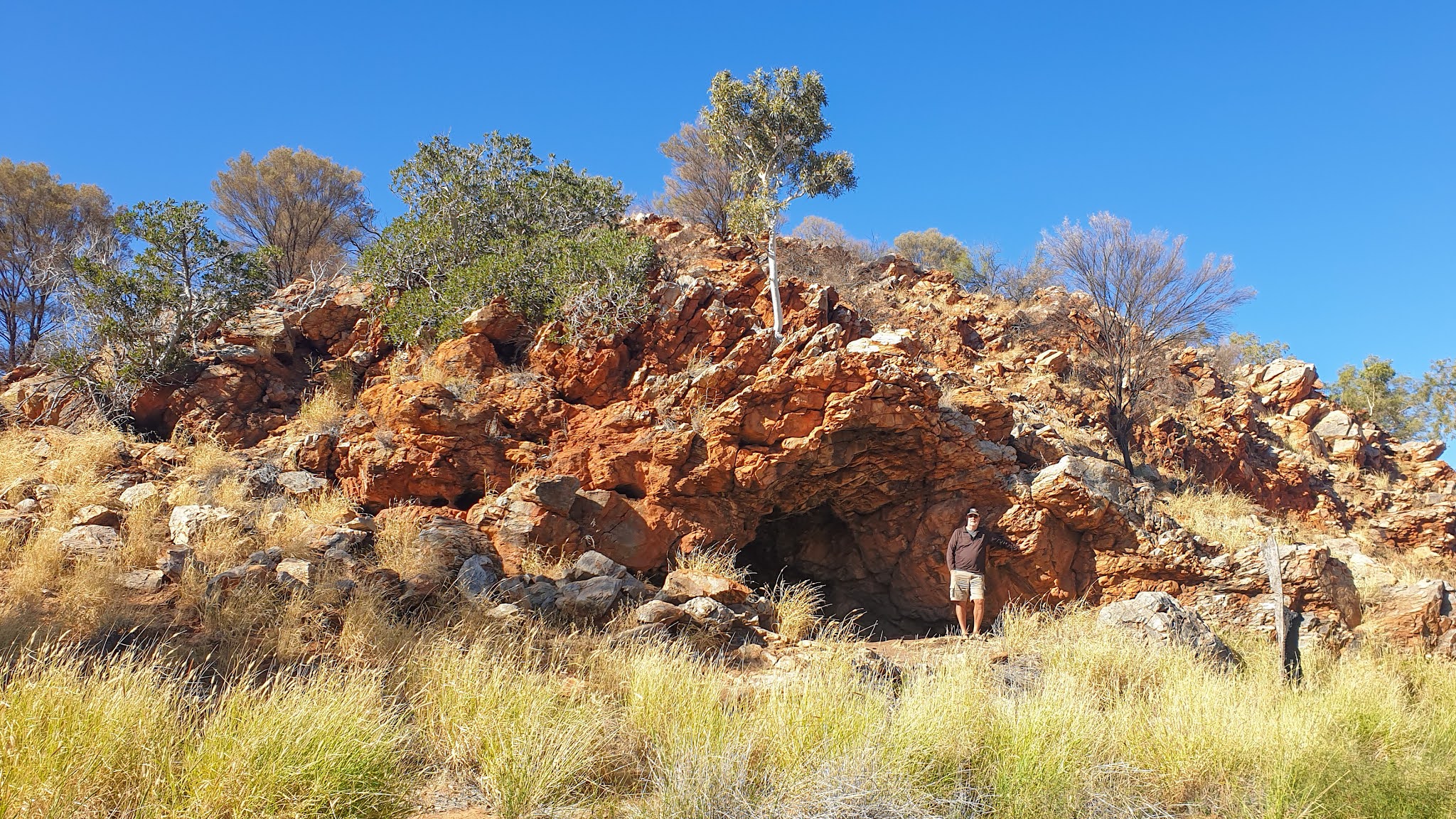
Not long after crossing the NT border, we stopped to visit a cave, a very famous one now called Lasserter’s Cave located amongst the Petermann Ranges. This is where Harold Lasserter took shelter for about 25 days in January 1931 whilst trying to re-find his fabled reef of gold now called Lasserters Reef after his camels had deserted him. Nobody has ever located this his reef of gold.
 |
Some wild brumbies joined us in front of the
Peterman Ranges as we neard the NT border |
 |
| Standing in front of Lasserter's Cave... at least we survived our visit |
Lasserter was being helped by the local indigenous people but decided to try and walk the 140 kms for help but being too weak from dehydration and malnutrition, died in the desert 55 kms into his journey, but his legend lives on.
Some BIG Rock(s)
The Great Central Road ends at the first of the BIG rocks of Kata Tjuta, previously known as the Olgas and whilst it was nice to leave the dirt road, we were suddenly surrounded by signs, tourist information and lots of other travellers.
 |
Leaving the dirt of the Great Central Road
now in the Northern Territory |
Being so close to Kata Tjuta, we found the road in to it and admired what lay in front of us.
 |
| Kata Tjuta looks special from both a distance and close up |
Yet again it was people busy and we had been fortunate to be able to book into the main campground in Yulara, a tourist township designed purely to service the thousands of visitors each year. We were only staying 2 nights and would have to move after the first night because everything was so booked out.
Over the next 2 days we visited the other big rock out here called Uluru, famous around the world and as usual, it did not disappoint. Our time at Uluru included doing some walking around its base to get up very close to its undulating surface before spending time as it changed colours during sunset.
 |
| With a full day of admiring Uluru we kicked it off at sunrise |
 |
| Uluru from a distance during the day |
 |
| Then we got up very close to 'the rock' |
 |
| Sun setting on Uluru from a the side where the climb to the top of the rock used to happen |
 |
| More traditional sunset view of Uluru |
Our final experience whilst in Yulara was to experience the field of lights consisting of 50,000 hand crafted lights standing on slender stems spread out across the equivalent of about 5 football fields. The lights almost pulse as their colours change, a true spectacle as we walked amongst them with the moon shining down above, the desert oaks being dimly bathed as the colours fluctuated.
 |
| Close up of the individual lights which make up this spectacle |
 |
| It was a pleasure to walk amongst these ever changing field of lights |
Eastwards & Home
Initially our journey back home involved turning south down the Stuart Highway running through the centre of Australia from north to south and over the next few days making our way back to Port Augusta, visiting nearby Quorn, before then starting our journey eastwards towards home.
 |
Drone view from our free camp us we made our way
south down the Stuart Hwy, the Ghan railway on the left |
 |
| Free camping near the Ghan railway and enjoying a camp fire |
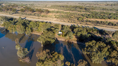
Whilst in SA early on in the trip, we had heard due to the severe flooding in NSW, huge volumes of water were flowing rapidly down the Darling River and had reached the Menindee Lakes, which were now filling up for the first time in about 10 years.
The decision was made to detour and visit, selecting lake Pamamaroo and finding a free camping spot nestled amongst the trees and right next to the lakes edge.
We had selected this lake because we thought it would give us some great photographic opportunities to capture sunsets across the water and the hundreds of dead trees the lake contains.
We were not disappointed!
 |
| Camping amongst the trees next to one of the Menindee Lakes |
 |
| The trees next to and in the lake made great silhouettes |
 |
| Nice way to enjoy dinner with a campfire during sunset |
 |
| The photographic opportunities during the 2 days we were here were endless |
We also decided to spend a few days again in and around the mining town of Broken Hill due to much cooler weather after the last time we visited when temperatures were around 43c, enabling us to have a better look at the ‘big pit’ or open cut mine site and some impressive sculptures out of town. |
Memorial to over 800 people who have died whilst
working as miners in Broken Hill since 1885 |
 |
| One of the sculptures located in the bush outside of Broken Hill |
A few small towns further east and another slight detour we set up camp in a town called Lightning Ridge, one of a few locations in the country where opal mining occurs. We liked this place because of its eclectic nature, sightseeing opportunities, including an underground mine filled with fabulous sculptures made by the owner using a simple knife. |
Rob next to one of the hundreds
of sculptures underground |
 |
| You do need to be careful wandering around in the scrub |
 |
| The cemetery had many crosses marked simply as 'Unknown' |
 |
| Some of the housing is ver eclectic and varied |
Not far from our caravan park was a free thermal pool we enjoyed soaking in for awhile before driving out into the bush to a designated location to view the mine dotted landscape and watch the sun set. |
| Soaking in the thermal pool |
 |
| Sunset over the opal mining holes scattered around Lightning Ridge |
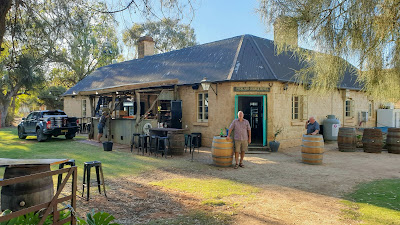
It didn’t take too much longer, and after visiting a few small towns and free camping next to a very small country pub, before 3 months on the road had passed and we backed our van into our driveway.
We were a little sad to be back home, despite having had to get border passes to enter Vic, SA, WA and NT plus having to obtain entry permits into 3 indigenous communities.
Depending on what happens with covid, all we need to do now is plan what travels to enjoy most likely in 2022 either hopefully overseas or within Australia.
CLICK HERE if interested in more photos of Southern Australia
Go well!