|
| Original itinerary, the areas in circles potential exploring areas |
Please keep in mind we were aiming to traverse part of a legendary route following an itinerary filled with visiting historical remote locations in areas also reputed for excellent wildlife sightings, including polar bear, walrus, narwhal, beluga whales, seals and so on.
The marketing material was beautifully written and hopes were high by most passengers we quickly learned, most of whom were very big travellers. We were heading into one of the planets last frontiers.
Our ship the Sylvia Earle, built in 2022 and named after a famous environmental scientist, with its curved forward bow, is very well appointed, consisting of an expedition team of 13 (zodiac drivers, gun handlers, guides etc) and ~77 crew to look after us.
 |
| Our ship the Sylvia Earle in the NWP |
During our first tour briefing by Sue, a very experienced expedition leader, the planned itinerary would have to change, which is quite typical we were told with these types of Arctic trips, due to the influence of wind, seas and ice. We were shown the sea ice maps, received daily, and how the ice had been moving and congregating due to wind and big seas pushing it.
During our first night whilst trying to sleep, we kept hearing banging sounds which we learned next day was the ship pushing through sea ice as it picked its way across Lancaster Passage and later in the day, we also experienced watching this from the bow (front) of the ship as it pushed its way through a lot of first year sea ice.
If the ice had been multi year sea ice, this would not have been possible. Multi year ice is a different colour and and its longer life as ice means it is significantly harder.
 |
Bow of the ship pushing
through sea ice |
 |
| View from our balcony as the sea ice gently scrapes past |
 |
| We did spot one harp seal amongst all the ice |
Everyone was reminded by Sue we were on an expedition and needed to adapt and be flexible, demonstrated by out first landing in Maxwell Bay on Devon Island, the largest uninhabited island on earth, at a location the ship had not visited before.
Devon Island is very very barren and has or is going to be used for training astronauts to live on and deal with Mars like conditions.
 |
| Starting a trek across the very barren Devon island |
 |
| The landscape on Devon Island is extremely barren |
During our walk around a tundra like surface, we learned about a range of flora, many of these plants looking to us like ground cover, but were in fact trees, some being very old trees with gnarly tree ‘trunks’. Many plants were nearing the end of their flowering season of a few months, and were exhibiting autumn colours.
 |
| Cotton plants in bloom |
 |
| Very old tree with gnarly trunk |
The cotton plants were used by the Inuit for ceremonies or for providing heat and light in earlier days using it as large rolled wicks in a bath of seal or whale oil from blubber.
 |
Inuit expedition member showing us how
they light the cotton tree flowers |
With an archeologist as part of the expedition crew, we found a potential Inuit heritage site, not recorded in their database, so its gps position was taken and photographed for submission to the Inuit who are now tracking these locations.
During periods whilst the ship searched for new locations to explore, the expedition crew ran presentations on a wide range of topics, including the history of the search for the NWP, which took 400 years to complete and included Captain Cook on his last fateful voyage.
The weather in terms of very strong winds, combined with ice blocking key locations has caused us to not get very far from Resolute, spending most of our time in either Maxwell Bay or Prince Regent Passage, almost opposite each other on Lancaster Passage, a passage used by most more recent attempts to find the NWP.
 |
| As we walked on Devon Island we found more plant species |
 |
| Walking back towards the zodiacs on Devon Island |
 |
| Icebergs visiting Devon Island |
Wind gust of up to 70 knots (over 120 kph) were being experienced, causing the seas to be very rough, resulting in numerous passengers not making it to breakfast one notable morning.
When we could, we would get off the ship to walk on land which initially was not very often as we needed smooth seas to launch and use the zodiacs, including the expedition crew going ashore to check for polar bears and areas we could safely walk on. If they spotted a polar bear anywhere onshore, there would be no landing.
Each afternoon we all met in the conference room for a summary of the day, go through the predicted ice, wind and sea conditions for the next day and possible plans. Quite often, the plans could only be finalised in the morning due to the conditions.
 |
Purple denotes very strong winds and that's
where we were... in the long section of purple |
Whilst cruising further into the western passage of Maxwell Bay, a polar bear was spotted fast asleep near the shore but still 2kms from us. The sound of the ship and our general presence, eventually caused the bear to sit up, take a good look at us before trotting away from the coast and out of sight but it was still very exciting for everyone to finally see some wildlife of note. Much of the wildlife is very wary of humans because the Inuit hunt them.
 |
| The polar bear woke up... sat up and then took off |
We also visited our first Inuit community of Arctic Bay, which doesn't normally receive ships and were given a cultural display of Inuit dancing where they mimic to movement of various animals eg. polar bear, muskox etc. Even one of the Royal Mounted Canadian Police based here was excited to see us and chat about anything we wanted.
 |
| The small community of Arctic Bay |
 |
| How we came ashore at Arctic Bay |
 |
| Chatting with the Royal Mounted Canadian Police |
One of the community competes in the Inuit Games and demonstrated the high kick involving a seal skin target held by string which is progressively raised until he could no longer kick it with one foot. |
| Local sharing an Inuit dance with us |
A doyen of the community also joined us, a lady who still makes all her own traditional clothes and sells them to make money for the local school. The very striking part of her endeavours is that she is 103! |
| The 103 yr old still makes all the clothes seen in this photo and more |
 |
Couldn't resist taking this photo of how the Inuit
carry their children (background removed) |
The bad weather continued as we zig zagged back and forth across Lancaster Passage searching for quiet places to support zodiac trips to shore or simply cruising around until one ‘zag’ took us to Baffin Island bound for another Inuit community called Pond Inlet.
Lancaster Passage is famous as the starting point for many expeditions searching for a way through the NWP starting with John Cabot in 1497, after multiple failed attempts, including one by James Cook, a major British expedition using 2 ships, lead by James Franklin in 1845 with 120+ people involved, all of whom perished and were last seen in the same Lancaster Passage.
They actually still don’t know what happened to them and why, but they did spend 3+ years stuck in the ice, they found some skeletons, three graves and in only 2014 then 2016, the 2 ships HMS Erebus and HMS Terror found. We had been experiencing bad weather and ice blockages common in the NWP.
The weather got us again when we arrived at Pond Inlet with 50 knot winds blowing and large waves leaving no choice but to abandon a landing and community visit, instead we turned east bound finally away from Lancaster Passage towards the east coast of Baffin Island.
Since the first crossing in 1903-1906, there have only been 350+ crossings through the full length of the NWP, which includes all cargo ships, occasional submarines, cruises like ours and yachts, which account for the majority of successful crossings. There are about 7 potential routes depending on draft depth of the vessels and all are subjected to wind, seas and ice.
After rapidly departing Pond Inlet we managed to find a stunning location and sunny skies for awhile, complimented with abundant ice to view and explore using the zodiacs. It is very strange to slowly cruise amongst sea ice in a small rubber boat!
 |
| Slowly cruising towards a glacier |
 |
| Balancing ice |
 |
| Very nice experience cruising the front of a glacier and other sea ice |
Over the next few days we explored various very long fjords along the east cost of Baffin Island which has an icecap on it like Greenland, each fjord putting on spectacular displays of massive cliffs up to 1.3 kms high, waterfalls, highly patterned rocks and small to large glaciers. |
| That rock face is 1.3 kms high |
 |
| The cloud and mist gave it an imposing feel |
And ice flows retreating back from the ocean
We anchored in front of one special glacier flowing directly from the icecap and still touching the sea, the only one that still does so on the island, whilst all the other glaciers had already retreated further up the mountains due to warmer average conditions.
 |
| The view we had from our dining room windows... not bad at all |
We were able to manage a few landings to simply walk around and in one case, climb a hill on the soft spongy tundra to gain glorious views back along the fjord.
 |
| Rob all rigged up and ready to go ashore |
 |
| View from the top of the hill we climbed |
 |
| Looking up the river from the bottom of the hill |
During one slow cruise towards the end of the fjord, we were lucky enough to spot the backs of some narwhals trying to get away from us. These were females so they did not have the legendary spike coming out of their heads. |
| Female narwhals trying to avoid our ship as we followed them |
 |
| Admiring the patterned rocks on the cliff walls |
 |
| Working our way from Baffin Island to the east |
But the time had come to direct the ship across Baffin Bay and east towards the west coast of Greenland crossing again through some rough seas with 4+ mtr waves and high winds. Again we were asked to always have one hand on the ship when trying to walk around and numerous sick bags were placed into the handrails throughout the ship for emergencies.
We had reached Greenland, the sun was shining, smooth seas and abundant small icebergs or growlers to keep our Russian Captain amused. Slowly cruising between Disko Island and the mainland, the Captain put on a bridge tour. What was notable with a ship only 12 months old, how modern and simple the bridge controls looked
 |
| What we passed coming into Disko Bay |
 |
| The Captain running a tour of an impressive bridge on the ship |
Time to go ashore for an explore along the beach on the mainland in Disko Bay. We got our first view of the Greenland icecap and the very green covering across the landscape on Greenland, here at least.
 |
| Our first view of the Greenland icecap |
 |
| All ready for another walk |
 |
| Part of the Disko Island coast |
We signed up for a long walk which first headed down to the beach, finding the remains of a small bowhead whale lying bleached on the shore, behind it stranded icebergs stuck to the ocean floor, also very close to the beach. Further along the beach was some sort of rock structure and a rock animal trap.
 |
| Dead bowhead whale watched over by a stuck iceberg |
 |
| Rock structure and coastline on Disko Island |
The walk continued, including having to cross a creek which one of the passengers fell into, lots of people trying to assist, as a he rolled slightly downstream, drowning and ultimately killing his camera. Wisely the walk leader found a simpler way back across the creek and decided we needed to climb a hill!! It was worth is though because of the view.
 |
| View from near the top of the hill |
 |
| Loading onto zodiacs for the trip back to the ship |
During the night, we slowly sailed south along the coast before anchoring in a town called Ilulissat, one of Greenlands main tourist ‘hot’ spots, the skies were quite clear, the seas now beautifully calm and going ashore to explore would be very easy.
This time we stepped off the zodiacs onto a floating structure rather than stepping into the water wearing our waterproof pants and rubber boots.
There were buses waiting for us, soon transporting us to the visitors centre located out of town close to the mouth of a large glacier coming directly from the massive Greenland icecap.
We elected to walk the 1.5kms along a well formed easy path to where the glacier calves off many icebergs a day into the ocean and the view was spectacular.
 |
| Walking down to where the icebergs calve into the ocean |
 |
| So impressive and look closely and you will see boats out with the icebergs |
A few small facts about this glacier stunned us. Due to the increased melting of the icecap and the instability of the ice, this glacier is moving towards the sea at 40 metres PER DAY! It is also most likely the glacier that gave birth to the iceberg the Titanic struck. The Inuit locals also told us the individual icebergs are now a lot smaller than in the past and scientists have calculated that this single glacier has raised sea levels by near to 4cms.
 |
| Standing near the face of the glacier |
The Visitors Centre has been simply but beautifully put together. You can walk on its roof for views of the city and inside are multiple displays crafted into ice looking structures and multiple video and virtual reality presentations all talking about the life of the ice, research happening on ‘the cap’ and how the Inuit survive and benefit from the ice. Very enjoyable.
 |
| The Visitors Centre overlooking Ilulissat |
 |
| Walrus tusk |
 |
| Various ice themed displays in the Visitors Centre |
We walked back to town instead of using a shuttle bus, passing large numbers of huskies chained across a large area suffering a little from the 12C heat of the day… it was very hot for them.
 |
| Husky camp in town |
 |
| Various homes and a church in Ilulissat |
In the afternoon we boarded a small aluminium boat directly from the ship for a 3hr tour around in and amongst the very large numbers of massive icebergs commencing their journey out to sea and their final grave.
Wow! This was quite the experience and we had placed ourselves outside at the front of the boat, which was great for photography BUT we soon learned with so much ice all around us, it was like sailing around in a huge freezer… we soon got cold, really cold, especially our hands which held metal cameras.
No other words need to be used… just stunning!
That night we experienced our first sunset for the trip as we had been experiencing 24 hour daylight, despite lots of cloud since departing Resolute, and the following morning we were anchored off the small town of Sisimiut, where we were soon on a short bus tour around town before walking as we pleased through the town visiting museums and famous old churches.
 |
| View from lookout to part of Sisimiut |
 |
| The relationship with the sea is always present |
 |
| Carving of whales on town's rock face |
 |
| Famous blue church of Sisimiut |
 |
| Museum display of old hut |
We were now on the home strait south towards yet another very long Fjord taking us to our final anchoring point near the very small town of Kangerlussauq, famous currently for 2 things.
With these sorts of trips you meet some wonderful other travellers to share the experience and also share their learnings from other trips they have taken. We met some wonderful people, especially the ones we enjoyed our final dinner with on the ship.
 |
| Sue, Colin, Bev and David were great to travel with through the NWP |
It is the only location on Greenland where you can drive to the icecap and it has the only runway capable of handling large planes because the runway was built by the USA Airforce during the cold war.
 |
| Last time off the zodiacs onto a floating dock |
We farewelled the ships crew who had been brilliant, and after landing ashore, found our way to tundra buggies for a town tour before enjoying a BBQ of muskox meat, lamb and beef.
Part of the town tour included driving to the top of a hill for a view, but our driver pointed out this strange looking device sitting atop the hill. “Can anyone guess what it is?” he asked, with answers like measuring the temperature and weather conditions being most common.
 |
| The device outside Kangerlussauq measuring Greenland rising |
“No” he said, “it is used to measure how much Greenland is rising as the icecap melts”, “it is rising about 1.5-2cms per year” he added. Jumping ahead a little, whilst sitting at the airport waiting to leave Kangerlussauq, i was sitting across from 2 geologists from Australia looking for ‘mineral stuff’ on Greenland.
They said, “yes Greenland is rising it is true and its called ‘Isostatic Adjustment’ “ and added, “ but other countries as a result of the melt from the last ice age 12,000 years ago are rising”. They advised New York and Norfolk, UK are sinking for example all due to the pliable and putty like nature of the earth’s hot mantle.
“This impacts on sea level measurements but is dealt with using NASAs Jason-3 satellites amongst other tools” they said.
We did in fact drive up near to the Greenland Icecap where yet another glacier was sending large volumes of melt water to the sea. Quite a sight considering at its highest, this ice is up to 3kms thick.
 |
| Our 'tundra buggy' heading towards the Greenland icecap in the distance |
 |
| Water flowing off the icecap |
 |
| Closer view of the edge of the icecap |
 |
| Closer view of the icecap |
On our way to and from the icecap… at long last, some more wild life in the form of a single large male caribou and then a male muskox feeding up in readiness for the breeding season, apparently. |
| Nice big male caribou |
 |
| Male muskox getting ready for the breeding season |
All the passengers except ourselves departed Kangerlussauq on a charter flight bound for Toronto from where they would scatter across the globe, whilst we stayed for one night before a flight heading east next day at midday.
Before departing, early next chilly morning, we went for a walk away from this little town of 500 hardy people to a nearby river flowing into the fjord we arrived into by our ship, to witness the roaring flow of water coming off the ice. It was quite a sight and in more recent times has generated flooding.
 |
| Ice melt water rushing to the fjord and out to sea |
Our entire Northwest Passage started off with high expectations around viewing wildlife and historic locations but had become in its own small way a repeat of what many others who venture into the arctic wilds of this area, a contest with wind, seas and ice. We however did it in comfort with 3 meals a day.
 |
| A more detailed of where our Northwest Passage journey took us |
 |
| So where to next? |
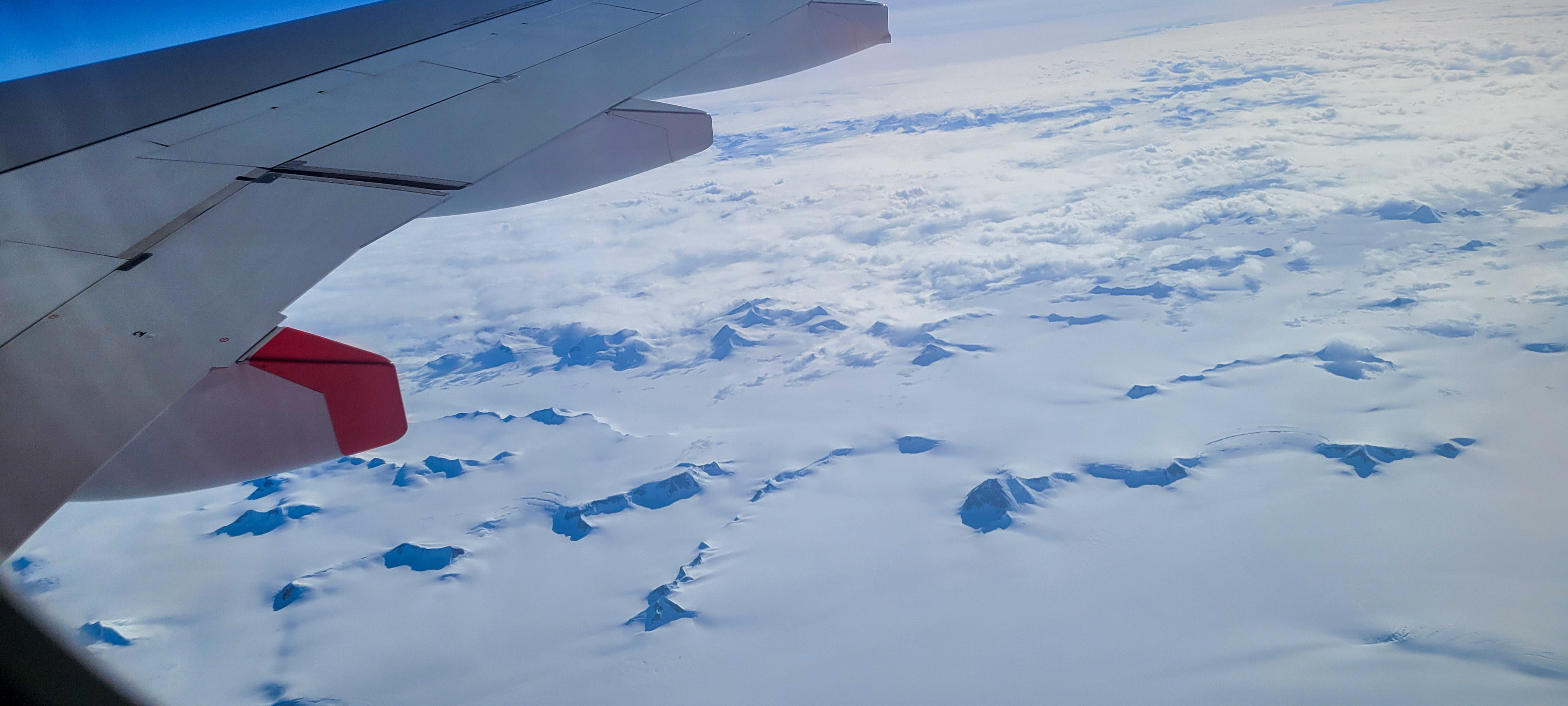
We settled into our seats on Air Greenland and headed east out and across the massive icecap to more interesting times but not quite the same as those we had just experienced.
 |
| Our plane taking us away from Greenland |
 |
| Flying over the massive icecap heading east |
CLICK HERE for more photos of NWP & Greenland
CLICK HERE for video Northwest Passage to western Greenland
So until the next post…. adieu and go well!